

Last Updated on August 6, 2026 by African Travel Hub Editorial
Namibia – Pre-Travel Information 2026-2027
Namibia is Africa’s road trip. No other country on the continent delivers the same combination of accessibility and wildness: a 4WD on a gravel road, a horizon with nothing on it, a sky that begins at your feet and ends at the edge of sight. It is the world’s second least densely populated country, protecting nearly 44% of its land under conservation management — yet it does so without demanding a professional guide, a fixed itinerary, or a camp booking made months in advance. Self-drive is the primary safari format. The Namib is the world’s oldest desert. Etosha’s floodlit waterhole at Okaukuejo is one of Africa’s finest free wildlife experiences. And Namibia’s black rhino population — the world’s largest free-roaming herd — is both an unsung conservation triumph and a wildlife encounter that few visitors elsewhere in Africa can match. This guide gives you every practical fact you need, structured so you can find answers fast.
1. Namibia at a Glance — Key Fast Facts
| FACT | DETAIL |
|---|---|
| Location | Southwestern Africa; bordered by Angola (north), Zambia (northeast), Botswana (east), South Africa (southeast and south), and the Atlantic Ocean (west) |
| Area | 824,292 km² (318,260 sq mi) — roughly the combined area of France and Germany, or half the size of Alaska |
| Capital | Windhoek (elevation ~1,654 m / 5,427 ft) — central highlands; administrative, judicial, and legislative capital; derives its name from the Afrikaans for “windy corner” |
| Population | ~3.1 million (2025 estimate) — the world’s second least densely populated country after Mongolia, at approximately 3.7 persons per km² |
| Official Language | English (government, education, and all tourism). Afrikaans is the most widely spoken first language (used in commerce and daily life). German is spoken by a significant minority, legacy of the colonial era. Indigenous languages — Oshiwambo, Herero, Damara/Nama, Kavango, Lozi — are widely spoken in their respective regions. |
| Currency | Namibian Dollar (NAD, N$). Pegged at 1:1 to the South African Rand (ZAR). The Rand is accepted everywhere in Namibia; the Namibian Dollar is only accepted within Namibia. August 2026 approximate rate: USD 1 ≈ N$16.50 (NAD 1 ≈ USD 0.06). |
| Time Zone | Central Africa Time (CAT) — UTC+2. No daylight saving time. |
| Electricity | 230 V / 50 Hz. Type M (South African 3-pin round plug, 15 A) is the most common. Some older properties also have Type D. Bring a universal adapter. Remote camps often operate on solar power; charge devices during daylight. |
| Driving | Left-hand traffic. A 4WD vehicle is strongly recommended for all major safari routes. Speed limits: 120 km/h (tarred B-roads), 100 km/h (C-roads/gravel), 80 km/h (D-roads/track). Do not drive after dark — unlit game, cattle, and unmarked culverts cause fatal accidents. |
| Internet | Good 4G in Windhoek, Swakopmund, Walvis Bay, and towns along main routes. MTC and Telecom Namibia are the main networks. National parks and remote areas have no mobile signal; most lodges and NWR camps use satellite. |
| Emergency Number | 10111 (police), 10177 (ambulance), or 112 from mobile |
| Conservation Model | First country in the world to inscribe environmental protection in its constitution (1990). Namibia’s communal conservancy network — 86 conservancies covering 170,000+ km² — is the world’s most successful community-based conservation programme. |
| Conservation Authority | Ministry of Environment, Forestry and Tourism (MEFT); Namibia Wildlife Resorts (NWR) manages national park accommodation. |
2. Namibia Visa & Entry Requirements (Updated 2026)
Important: Namibia changed its visa policy significantly from 1 April 2025, introducing a reciprocity-based visa requirement for 33 countries — including the USA, UK, Germany, France, Australia, and Canada — that had previously enjoyed visa-free access. Many travellers arrived in 2025 unaware of this change. Read this section carefully before booking.
2.1 The New Reciprocity Policy — Who Needs a Visa?
Namibia announced in May 2024 that it would apply the principle of diplomatic reciprocity: nationals of countries that require Namibian citizens to obtain a visa must now obtain a visa to enter Namibia. The policy took effect 1 April 2025, formalised through the Namibian Ministry of Home Affairs, Immigration, Safety and Security (MHAISS).
Nationalities now requiring a visa (from 1 April 2025):
| REGION | AFFECTED NATIONALITIES |
|---|---|
| Europe | United Kingdom, Germany, France, Netherlands, Italy, Spain, Portugal, Belgium, Switzerland, Austria, Sweden, Norway, Denmark, Finland, Iceland, Ireland, Luxembourg, Liechtenstein |
| North America | United States, Canada |
| Asia-Pacific | Australia, New Zealand, Japan, South Korea |
| Eastern Europe / Central Asia | Ukraine, Belarus, Armenia, Azerbaijan, Kazakhstan, Kyrgyzstan, Moldova, Tajikistan, Turkmenistan, Uzbekistan |
How to obtain your visa — two options:
(A) eVisa / Online Pre-Approval (Recommended): Apply at eservices.mhaiss.gov.na before departure. Complete the online form, upload a passport photo and biographical page, and pay online. On approval, you receive a pre-approval notice by email. Print this and carry it to Namibia — the actual visa stamp is still issued when you arrive at a designated port of entry. The online process reduces congestion and risk at the border but does not produce a fully digital visa.
(B) Visa on Arrival: Available at designated ports of entry — pay the fee in cash on arrival. Strongly recommended to pre-apply online to avoid queues, particularly at Hosea Kutako International Airport during peak season.
Visa fee: N$1,600 per person (~USD 97 at August 2026 exchange rates) for non-African Union citizens. Children under 6: exempt. African Union country nationals pay N$1,200.
Visa validity: 30 days, multiple entry. Valid for tourism only.
Ports of entry where visa on arrival is available: Hosea Kutako International Airport (Windhoek), Walvis Bay International Airport, Oshikango, Trans-Kalahari, Oranjemund, Noordoewer, Katima Mulilo, Impalila Island, Ngoma, and Mohembo border posts.
Diplomatic exemption: Holders of diplomatic and official passports from Germany, Switzerland, and France are exempt from the visa fee; confirm with your country’s mission before travel.
2.2 Visa-Free Entry — Who Does Not Need a Visa?
Approximately 55 countries retain visa-free access to Namibia, primarily SADC neighbours and specific bilateral treaty partners. These nationalities receive an entry stamp on arrival at no charge.
Key visa-free nationalities:
| REGION | VISA-FREE NATIONALITIES |
|---|---|
| Africa | South Africa, Botswana, Zimbabwe, Zambia, Mozambique, Angola, Tanzania, Kenya, Malawi, Lesotho, Eswatini, Seychelles, Mauritius |
| Americas | Brazil, Cuba, Jamaica |
| Asia / Pacific | Malaysia, Singapore, Hong Kong (SAR), Macau (SAR), Indonesia |
| Europe | Russia |
For the authoritative and current list, consult the MHAISS official portal or the Namibia Ministry of Home Affairs. Lists change; verify before departure.
2.3 Passport & Entry Requirements (All Visitors)
- Passport validity: Minimum 6 months beyond your planned departure date from Namibia
- Blank pages: Minimum 3 blank pages for stamps and visa
- Onward travel: A return or connecting flight booking may be requested; carry a printed copy
- Proof of accommodation: Lodge confirmations or a host’s letter for land-border entry points
- Yellow fever certificate: Required only if arriving from a yellow fever-endemic country — see Section 5
- Duration of stay: Standard tourist entry period is up to 90 days (for visa-free nationals); visa holders receive 30 days
- No departure tax is payable in cash at Namibian airports
2.4 Travelling with Children Under 18
Namibia strictly enforces documentation requirements for minors, modelled on South Africa’s regulations:
- All children under 18 must carry their unabridged birth certificate (listing both parents)
- If travelling with one parent: notarised parental consent letter from the absent parent with identity document details
- If travelling with neither parent: notarised consent from both parents plus the responsible guardian’s contact details in Namibia
- Airlines serving Namibia from South Africa enforce these rules at check-in; missing documents can prevent boarding
3. Best Time to Visit Namibia
Namibia’s tourism season aligns with its dry winter — the most dramatic inversion of what most visitors expect. The finest months are the coldest, and the hottest months offer the best dune photography.
| PERIOD | CONDITIONS | HIGHLIGHTS |
|---|---|---|
| May – Jun (Early Dry) | Cooler (10–25°C); vegetation still tinged green from rains; excellent road conditions. | Game concentrating at waterholes in Etosha. Dunes vivid from recent rain. Good value, before peak season prices. Roads accessible after wet season. |
| Jul – Sep (Peak Season) | Clear blue skies; cold mornings and nights (can drop to 0°C or below in the south and at altitude); warm days (22–28°C). Very busy at Etosha and Sossusvlei. | Best game viewing in Etosha — wildlife at maximum waterhole concentration. Dune climbing comfortable in morning coolness. Milky Way photography exceptional (no humidity, minimal light pollution). Book accommodation 6–9 months ahead. |
| Oct – Nov (Hot, Pre-Rains) | Very hot (35–42°C in Etosha; 38°C+ at Sossusvlei midday). Rains may begin in late November. | Best dune photography (extreme heat creates vivid colors; fewer people). Excellent game viewing as dry conditions intensify. Fish River Canyon hiking season ends October 14. National Geographic-quality landscapes. Early evening cools significantly. |
| Nov – Apr (Wet Season) | Rains arrive (predominantly afternoon thunderstorms); some gravel roads flood or become impassable. Etosha may flood at Okaukuejo. | Outstanding birdwatching — 200+ migratory species arrive. Wildflower season on the Sperrgebiet and southern Namib (August–September in Namaqualand). Newborn animals; predator activity around young prey. Dramatically lower prices. Some lodges close. |
| May – Sep (Fish River Canyon Hiking) | Canyon trail accessible only May through mid-October (typically May 1 – October 14). Outside this window, the trail is officially closed. | 85 km Fish River Hiking Trail — one of Africa’s iconic multi-day hikes; minimum group of 3; doctor’s certificate required. |
| Oct – Apr (Desert Flowers, South) | Unusual rainfall triggers extraordinary ephemeral wildflower blooms | Namaqualand / southern Namib daisy fields; rare and weather-dependent; can be spectacular |
Bottom line: For the definitive Namibia experience — Etosha game viewing at peak + Sossusvlei climbing in comfort + Fish River Canyon open — June through September is optimal. For dramatic dune photography without crowds, and tolerance for heat, October is exceptional. For budget travel and birdwatching, November–April offers significant savings.
4. Namibia’s Top Destinations
Namibia’s attractions are spread across an enormous territory, requiring driving distances that dwarf comparable safari circuits elsewhere. The classic 14-day Namibia circuit (Windhoek → Sossusvlei → Swakopmund/Skeleton Coast → Damaraland → Etosha) covers approximately 3,000 km. Budget 4–6 hours of driving between major destinations.
4.1 Etosha National Park — Africa’s Waterhole Safari
At 22,270 km², Etosha is Namibia’s premier wildlife destination and one of Africa’s great safari parks. Its character is defined by the Etosha Pan — a 4,800 km² salt flat, the remnant of a vast lake that dried up millions of years ago, visible from space — around which the park’s wildlife concentrates at permanent waterholes sustained by underground springs.
What makes Etosha different from any other safari park: The open, white-salt landscape means game is visible from enormous distances with no vegetation concealment. Etosha’s wildlife viewing is primarily waterhole-centred rather than vehicle-trailing, creating a fundamentally different rhythm — you park at a waterhole and wait for the drama to arrive. The floodlit waterhole at Okaukuejo camp is one of Africa’s most celebrated free wildlife experiences: underground spring, artificial lighting, and an open viewing area allow visitors to watch elephant, black rhino, lion, and giraffe arrive at the water from sunset through the entire night. Entry to the waterhole is included in the camp fee.
Wildlife: 114 mammal species and 340+ bird species. Key animals: African elephant, African lion, African leopard, cheetah, black rhino (Etosha holds Africa’s largest single-park black rhino population — approximately 400–500 individuals), white rhino, spotted hyena, wild dog (rare), giraffe, plains zebra, Hartmann’s mountain zebra, blue wildebeest, springbok, oryx (gemsbok), eland, kudu, roan antelope, red hartebeest, bat-eared fox, black-backed jackal, aardwolf, black-footed cat.
Park structure:
| ZONE | CHARACTER | NOTES |
|---|---|---|
| Western sector (Galton / Etosha Heights) | Rough terrain; rugged hills; less visited | Better for rhino sightings; accessible from Galton Gate |
| Central sector (Halali area) | Mixed woodland and open salt pan edge | Halali waterhole excellent at night; less crowded than Okaukuejo |
| Eastern sector (Namutoni / Fischer’s Pan) | Dense mopane woodland; red-billed oxpecker visible | Fischer’s Pan fills seasonally; flamingo flocks; Namutoni fort (1904 German colonial structure) |
Entry gates: Anderson’s Gate (south — primary public entry, nearest from Windhoek); King Nehale Gate (north, from Ondangwa); Galton Gate (west, from Damaraland); Von Lindequist Gate (east, from Tsumeb).
Park hours: Gates open sunrise to sunset only (approximately 06:00–19:00 seasonally). All visitors must be inside NWR camp or out of the park by gate closure — no exceptions; rangers enforce this strictly.
NWR accommodation in Etosha: Three NWR-operated resorts: Okaukuejo (iconic; central; underground waterhole), Halali (central; quiet), Namutoni (eastern; historic fort). All offer campsites, bungalows, and restaurant facilities. Book directly through NWR at www.nwr.com.na — NWR sites fill 6–9 months ahead for July–September.
Numerous private lodges operate just outside park boundaries on the western and eastern approaches (Ongava Private Game Reserve is the most acclaimed on the southern boundary; Etosha Heights on the western; Onguma on the eastern).
4.2 Namib-Naukluft National Park & Sossusvlei — The World’s Oldest Desert
The Namib Desert is the world’s oldest desert, estimated at 55–80 million years old — predating the separation of Africa and South America. The Namib-Naukluft National Park (49,768 km²) protects its most spectacular central section. Within the park, the Sossusvlei area contains the landscapes that define Namibia internationally.
The geological superlatives:
- The Namib-Naukluft is the largest conservation area in Africa and the fourth-largest in the world
- Sossusvlei’s dunes are among the world’s highest — the tallest, Big Daddy Dune, rises approximately 325 m (1,066 ft) from the valley floor
- Dune 45 — 170 m high and 45 km from Sesriem gate — is the most-photographed dune in Africa
- The dunes’ iron-rich quartz sand gives them their extraordinary red-orange colour, intensified at sunrise and sunset
The three main sites:
Deadvlei: A white clay pan enclosed by towering orange dunes. Dead camelthorn trees, standing for over 900 years, are preserved by the extreme dryness — they died when the Tsauchab River changed course and cut off their water supply approximately 700 years ago. Deadvlei is one of Africa’s most extraordinary photography subjects: black dead trees, white salt floor, crimson dune walls, and a perfect blue desert sky. There are no roads across the pan — visitors walk 1 km from the Sossusvlei parking area.
Sossusvlei: An ephemeral lake bed (vlei) that fills with water only in exceptional rain years. Surrounded by the highest dunes in the area. The 4WD track to Sossusvlei (6 km beyond the 2WD parking area) is the only sandy track in this section; for 2WD vehicles, an NWR shuttle operates from the parking area (N$200 adult / N$100 child).
Sesriem Canyon: A 1 km-long, 30 m-deep canyon carved by the Tsauchab River into 15-million-year-old conglomerate and gravel. A short 10-minute walk from the gate. The only permanent water visible in this landscape during dry season. Swimming is not permitted but the slot-canyon geology is striking.
Access and logistics:
The only entry to Sossusvlei is via Sesriem Gate (2 km from the Sesriem NWR camp and the private lodge cluster). The gate opens 1 hour before sunrise — critical timing, because dune climbing is best in the first 2 hours of light before heat becomes extreme and before the majority of day visitors arrive. Guests staying at NWR Sesriem Campsite or the lodges inside the gate can access the dunes before gate opening for other visitors.
Welwitschia mirabilis: The Namib’s most extraordinary botanical resident — a plant so unusual that it belongs to its own taxonomic order. Living fossils that can survive 1,000–2,000 years, many recorded individuals are over 1,000 years old. They have only two leaves (which split and become shredded by wind over centuries) and absorb moisture from desert fog. Found in the Namib Desert between Swakopmund and the Ugab River; guided Welwitschia excursions available from Swakopmund.
4.3 The Skeleton Coast
The Skeleton Coast is one of Africa’s most dramatic and uninviting coastlines — and one of its most extraordinary wildlife landscapes. The Atlantic meets the Namib Desert along 500 km of bone-white beach between the Ugab River mouth (south) and the Kunene River (the Namibia–Angola border at the north).
The name: Portuguese sailors called this stretch “The Sands of Hell”; the local San people knew it as “The Land God Made in Anger.” The modern name comes from the whale and elephant bones that once littered the beaches, and from the bleached skeletons of the thousands of sailors whose ships were driven onto this coast by Atlantic swells and the Benguela Current — unable to walk back through 500 km of desert, they died here. Over 1,000 ships have been wrecked along this coast; many are visible from the road.
The Benguela Current: Cold upwelling from the deep Atlantic creates the Skeleton Coast’s unique character. It is responsible for Namibia’s coastal fog (which sustains the desert ecosystem), the cold ocean temperature (rarely above 14°C), and one of the world’s richest marine systems: the fog and cold water together support a food chain that includes millions of Cape fur seals, thousands of Cape gannets, large flamingo flocks, brown hyena, black-backed jackal, and the desert-adapted lions and elephants that have learned to follow this coastal food chain.
The Coast divides into two distinct sections:
Southern Skeleton Coast (Ugab River to Springbokwasser): Self-drive accessible. Key highlights:
- Cape Cross Seal Reserve (130 km north of Swakopmund): The largest Cape fur seal colony in the world — an estimated 80,000–100,000 animals, with numbers peaking in the November–January birthing season. The smell, sound, and sheer mass of seals is extraordinary. Entry fee required; day visitors only.
- Eduard Bohlen Shipwreck: German cargo ship wrecked in 1909, now stranded approximately 500 m inland from the current waterline as dune migration has pushed the shore seaward. Visible from the D1807 road.
- Messum Crater: A collapsed ancient volcanic structure with unique geology and wildlife; gravel road access.
- Lichen fields, seal colonies, shipwreck sites, and desert-fog ecosystem.
Northern Skeleton Coast Park (Springbokwasser to Kunene River): No self-drive; access by licensed operator only. This wilderness — the most remote and protected stretch — contains desert-adapted lions (an estimated 150+ individuals that have evolved behaviours unique to coastal desert survival), desert elephants, brown hyena, and enormous Cape fur seal aggregations. Only two operators are licensed to access the deep north: Wilderness Safaris (Hoanib Skeleton Coast camp — fly-in, all-inclusive, extremely exclusive) and one or two others. Access is by light aircraft to bush airstrips; road access is not available to the public.
A permit is required even for self-drive entry to the southern Skeleton Coast Park section beyond the Ugab River gate. Purchase at the gate. Day visitors must exit before the gate closes at sunset.
4.4 Damaraland — Desert Giants and Ancient Rock Art
Damaraland is the informal name for a vast volcanic landscape in northwestern Namibia between the Skeleton Coast and the Kunene River region. Not formally a national park but a mosaic of communal conservancies, private reserves, and Ministry-managed areas. It is home to three of Namibia’s most important wildlife and cultural experiences.
Desert-adapted elephants: Approximately 150 desert-adapted African elephants survive in Namibia’s arid northwest, having evolved distinctive physiological and behavioural traits to survive in a landscape where rainfall averages less than 100 mm per year. They travel distances of up to 70 km between water sources, feed on dry riverbeds and desert vegetation, and display smaller body mass and larger feet compared to savannah elephants. The primary viewing area is the Hoarusib, Hoanib, and Huab river systems. Guided tracking excursions from Palmwag, Damaraland Camp, and Desert Rhino Camp offer the most reliable encounters; elephant-vehicle behaviour is well understood by local trackers. This is not guaranteed wildlife — a morning of tracking in dry riverbeds is as much of the experience as the elephants themselves.
Black rhino tracking: Damaraland holds a significant portion of Namibia’s wild black rhino population. The Save the Rhino Trust (SRT), in partnership with community conservancies, conducts rhino monitoring and offers community-based rhino tracking guided experiences from Palmwag. The tracking is on foot with armed community rangers; encounters are managed at responsible distances; the experience is considered one of the finest and most ethically structured in Africa.
Twyfelfontein (UNESCO World Heritage Site 2007): One of the largest concentrations of ancient rock engravings (petroglyphs) in Africa — over 2,500 engravings cut into red sandstone outcroppings by San hunter-gatherers over the past 5,000–6,000 years. Images include hunting scenes, animal tracks, lion, rhino, elephant, oryx, and giraffe, as well as human figures. The name means “Doubtful Spring” in Afrikaans — a reference to the unreliable water source around which the community sustained itself. Guided visits only, run by local community guides; a UNESCO-compliant visitor centre explains the cultural and historical context. Allow 2 hours minimum.
Spitzkoppe: A dramatic granite inselberg (“island mountain”) rising 600 m from the surrounding desert plain to 1,728 m above sea level. Called the “Matterhorn of Namibia” for its iconic profile. The Spitzkoppe community campsite and surrounding campsites offer direct access to rock climbing routes, San cave paintings, natural arches, and extraordinary stargazing. Most accessible overnight stop on the route between Swakopmund and Damaraland.
Brandberg: Namibia’s highest point at 2,573 m — a rounded granite massif rising from the desert. Famous for the White Lady — a San rock painting approximately 2,000 years old in Maack’s Shelter on the western face. The painting depicts a figure, originally interpreted as a white-skinned woman (which fuelled colonialist fantasies of non-African origin); modern scholarship identifies it as a male shaman figure. The walk to the painting is 2 hours return; guides mandatory.
Petrified Forest (near Khorixas): 50+ ancient tree trunks, up to 34 m long, that fell in a flood 280 million years ago and have turned to stone (silicified) in situ. The trees are from an ancient species and have no relatives in Namibia today. Found scattered on the surface, preserved by the desert’s aridity. National Monument; registered guides required.
4.5 Fish River Canyon
The Fish River Canyon in southern Namibia is one of the world’s great canyons — 160 km long, up to 27 km wide, and 550 m deep — the largest canyon in Africa and one of the largest in the world. Carved by the Orange River’s predecessor over 500 million years and by the Fish River over the past 50 million, it divides into the canyon viewpoints administered through the Ai-Ais/Richtersveld Transfrontier Park.
Two experiences:
Viewing (year-round): The Main Viewpoint at Hobas and the Hiker’s Viewpoint (accessible by car on the rim) provide dramatic panoramic views into the canyon. Sunset from the rim, with the canyon walls shifting from grey to gold to burgundy, is one of Namibia’s finest photographic opportunities. Short rim walks connect several viewpoints.
The Fish River Hiking Trail: 85 km through the canyon floor over 4–5 days — one of Africa’s iconic multi-day wilderness hikes. Hikers walk unsupported (no guide, no resupply, no shelter beyond their own camping gear) through the canyon, following the Fish River over sand, rock shelves, and boulder fields. The trail is only open May 1 to approximately October 14 annually, when temperatures are tolerable.
Requirements: Maximum 30 hikers in total on the trail simultaneously; minimum group of 3; a doctor’s certificate of fitness (issued within the past 40 days) is required to register; advance booking through NWR is mandatory; a Wilderness Card entry permit must be purchased on arrival at Hobas. There is no rescue evacuation possible inside the canyon — fitness is a serious prerequisite.
Ai-Ais Hot Springs: At the southern end of the trail, the resort’s thermal baths (springs at 60°C, cooled to 49°C in pools) are the hikers’ traditional recovery destination. The resort is also accessible by road from the south without doing the hike.
4.6 Zambezi Region (Former Caprivi Strip)
The Zambezi Region is Namibia’s geographical anomaly: a narrow finger of land (450 km long, 32–100 km wide) extending northeast from the main body of Namibia to the Zambezi River, sharing borders with Zambia, Zimbabwe, Botswana, and Angola. Geographically, ecologically, and culturally, it has almost nothing in common with the rest of Namibia — it is subtropical, well-watered by the Zambezi, Chobe, Kwando, and Okavango rivers, and covered in riparian forest and floodplains.
National parks in the Zambezi Region:
- Bwabwata National Park — 6,100 km²; encompasses the Kwando and Okavango river systems; excellent elephant, lion, wild dog, sitatunga, buffalo; the Mahango Core Area is the most productive game-drive section; closest airport is Katima Mulilo
- Mudumu National Park — 1,010 km²; bordering the Kwando River; elephant, hippo, buffalo, sitatunga, reedbuck, lion, and wild dog; some of Namibia’s finest river safari experiences
- Nkasa Rupara National Park (Mamili) — 320 km²; seasonally flooded; sitatunga and reedbuck in extraordinary densities; remote and rarely visited; Impalila Island (at the meeting point of Zambia, Zimbabwe, Botswana, and Namibia) lies at the eastern tip
The Zambezi Region is the only part of Namibia with reliable malaria risk — essential prophylaxis required year-round (see Section 5).
Access: Katima Mulilo (the region’s main town) is served by Air Namibia’s successor carriers from Windhoek. The B8 “Trans-Caprivi Highway” (now officially called the Trans-Zambezi Highway) is the only tarred road through the region.
4.7 Swakopmund — Namibia’s Coastal Capital
Swakopmund is Namibia’s most distinctive town: a thriving German colonial resort on the Atlantic shore, surrounded entirely by the Namib Desert. Founded in 1892, it retains an extraordinary inventory of German imperial architecture — Wilhelmian facades, a lighthouse, a pier, and a railway station that would not be out of place in Bavaria. This is not colonial-kitsch; it is genuinely one of the best-preserved examples of German colonial urban design in Africa.
Why Swakopmund is on every Namibia itinerary:
- It is 350 km west of Windhoek on a tarred road (4 hours)
- It is the nearest town to Sossusvlei (4 hours south) and Damaraland (3–4 hours north)
- Its restaurants, accommodation standards, and facilities are the best outside Windhoek
- It serves as the adventure-activities hub for the Namib coast
Adventure activities available from Swakopmund:
- Sandboarding (on the dunes south of town) — sledge-style boards on the dune face; the 100m-high dunes near Swakopmund offer runs of up to 80 km/h on wooden boards (Dunehoppers is the established operator)
- Quad biking on desert dunes
- Skydiving over the desert-coast landscape
- Dolphin and seal cruise from Walvis Bay (7 km south): catamaran trips past oyster farms, pelicans feeding alongside the boat, Cape fur seals boarding the vessel for fish scraps, and Heaviside’s and bottlenose dolphins
- Kayaking with seals at Pelican Point (Walvis Bay)
- Paragliding over dunes
Walvis Bay (7 km south of Swakopmund): Namibia’s principal port, and home to a spectacular flamingo lagoon — large flocks of both greater and lesser flamingo use the Walvis Bay Lagoon as a year-round feeding ground. The lagoon is a Ramsar Wetland of international importance; 70,000+ waterfowl have been recorded. Evening walks or cycling along the lagoon promenade with flamingos is one of Namibia’s most accessible and underrated wildlife experiences.
Cape Cross Seal Reserve (130 km north of Swakopmund on the C34): Home to the world’s largest Cape fur seal colony — up to 100,000 animals during the November–January pupping season. The noise, smell, and sheer density of seals at close range (viewing platform 10–20 m from the colony) is overwhelming and unforgettable. Entry fee applies.
4.8 National Park Entry Fees (2026)
New fee structure effective 1 April 2026, set by the Ministry of Environment, Forestry and Tourism (MEFT). Fees are per person per day (24-hour periods) and per vehicle per day.
Premium Parks (Etosha, Namib-Naukluft/Sossusvlei, Skeleton Coast, Waterberg Plateau, Ai-Ais):
| VISITOR CATEGORY | CONSERVATION FEE (PER ADULT/DAY) | USD EQUIVALENT |
|---|---|---|
| International (non-SADC) | N$280 | ~USD 17 |
| SADC residents | N$180 | ~USD 11 |
| Namibian citizens | N$60 | ~USD 3.60 |
Standard Parks (Bwabwata, Mudumu, Khaudum, Nkasa Rupara, Mangetti, and others):
| VISITOR CATEGORY | CONSERVATION FEE (PER ADULT/DAY) | USD EQUIVALENT |
|---|---|---|
| International (non-SADC) | N$200 | ~USD 12 |
| SADC residents | N$120 | ~USD 7.25 |
| Namibian citizens | N$40 | ~USD 2.40 |
Vehicle fees (all parks):
| VEHICLE TYPE | FEE (PER DAY) | USD EQUIVALENT |
|---|---|---|
| ≤10 seats | N$60 | ~USD 3.60 |
| 11–25 seats | N$150 | ~USD 9 |
| 26–50 seats | N$600 | ~USD 36 |
| 51+ seats | N$1,000 | ~USD 61 |
Sossusvlei shuttle fee (NWR-operated shuttle from 2WD parking to Sossusvlei pan):
| VISITOR | FEE | USD EQUIVALENT |
|---|---|---|
| Adult | N$200 | ~USD 12 |
| Child under 12 | N$100 | ~USD 6 |
Children under 8 enter all national parks free of charge. Children 8–16 pay 50% of the adult conservation fee.
Critical note for 2026 self-drive visitors: NWR-operated camps at Okaukuejo, Halali, Namutoni (Etosha), and Sesriem (Sossusvlei) have experienced fuel supply disruptions throughout 2025 and into 2026. Do not rely on fuel availability inside any Namibian national park. Fill your tank completely before entering Etosha and before reaching Sesriem. Carry at least 20 litres of extra fuel for any Damaraland or Skeleton Coast route.
5. Health & Vaccinations for Namibia
Consult a travel medicine specialist or your GP at least 4–6 weeks before departure.
5.1 Required Vaccinations
Yellow Fever Certificate (REQUIRED if arriving from an endemic country):
Namibia requires proof of yellow fever vaccination if you have transited through or visited a yellow fever-endemic country (including Kenya, Uganda, Tanzania, DRC, Nigeria, and Brazil) within 6 days of arrival. Flying directly from Europe, North America, South Africa, or Australia does not trigger this requirement.
The WHO considers the vaccination valid for life. Carry your International Certificate of Vaccination (yellow card) with your passport. For the current list of endemic countries: WHO Yellow Fever Country List.
5.2 Strongly Recommended Vaccinations
| VACCINE | WHY IT MATTERS FOR NAMIBIA |
|---|---|
| Hepatitis A | Recommended for all travellers regardless of accommodation standard |
| Typhoid | Recommended for all travellers |
| Hepatitis B | Recommended if potential exposure to blood or body fluids is possible |
| Tetanus / Diphtheria / Pertussis (Tdap) | Ensure your booster is current |
| Measles, Mumps, Rubella (MMR) | Confirm full vaccination before international travel. CDC Advisory 2025 |
| Rabies (pre-exposure) | Recommended for those spending extended time in remote areas; post-exposure treatment in remote desert is many hours away |
| Polio | Confirm adult lifetime booster |
5.3 Malaria
Malaria risk in Namibia is geographic and seasonal, unlike the year-round risk in Zambia or Zimbabwe. This distinction is important for planning.
Malaria-FREE areas (no prophylaxis needed):
- Windhoek and central highland plateau
- Swakopmund, Walvis Bay, and the entire Atlantic coast
- Sossusvlei / Namib Desert
- Fish River Canyon and southern Namibia
- Etosha National Park (low risk; some authorities recommend prophylaxis May–November; consult your physician)
Malaria RISK areas (prophylaxis required):
- Zambezi Region (Caprivi Strip): year-round, high risk — Bwabwata, Mudumu, Nkasa Rupara, and all river-adjacent areas
- Kavango East and West regions (year-round, moderate)
- Kunene/Kaokoveld (seasonal, lower risk)
- Northern Namibia above the Veterinary Cordon Fence: elevated risk November–April
If your itinerary is Namibia’s classic circuit (Windhoek → Sossusvlei → Swakopmund → Damaraland → Etosha) without visiting the Zambezi Region, malaria prophylaxis may not be required but consult a physician for personalised advice.
If visiting the Zambezi Region, the same high-risk protocols as Zambia apply — chloroquine-resistant P. falciparum; atovaquone/proguanil (Malarone) or doxycycline recommended.
For current guidance: CDC Travellers’ Health — Namibia and NaTHNaC — Namibia.
5.4 Other Health Precautions
- Water: Windhoek’s municipal water is clean and drinkable. In remote areas and national parks, use bottled or purified water. NWR camps provide safe water at ablution facilities.
- Sun and heat: The Namib is an extreme environment. At Sossusvlei in October, midday temperatures can reach 45°C on the dune surface. Dune climbing must be done at first light or on overcast days. Carry a minimum of 3 litres of water per person for any dune excursion. SPF 50+; wide-brimmed hat; UV-protective long-sleeved shirt.
- Medical facilities: Windhoek has private hospitals (Mediclinic Windhoek, Rhino Park Private Hospital) with good standards. Swakopmund has State Hospital and one private clinic. Remote areas — Sossusvlei, Damaraland, Skeleton Coast, Etosha — have no medical facilities beyond a first aid kit. Medical evacuation insurance is essential; confirm your policy covers helicopter or fixed-wing evacuation from remote Namibian parks.
- Sandstorms: Occasional in the Namib, particularly the southern Namib. Reduce speed; pull over; wait for the storm to pass. Sand damages camera lenses and fills engines — keep air filters clean.
- Wildlife: Namibia has a significantly lower density of dangerous wildlife at road level than East or Central Africa, but still: stay in your vehicle in Etosha at all times unless at a designated stop; do not approach seals at Cape Cross on foot (they bite); don’t leave food in tents in the Zambezi Region.
6. Getting to Namibia — International Airports
Namibia is served by three commercial airports managed by the Namibia Airports Company (NAC):
6.1 Hosea Kutako International Airport (WDH) — Windhoek
Namibia’s principal international gateway, located 45 km east of Windhoek city centre on the B6 highway. The airport handles the vast majority of long-haul arrivals and all major airline connections.
Key international services:
- Ethiopian Airlines (Addis Ababa) — primary connection to Europe, Asia, and North America via Addis Ababa Bole International Airport; daily service
- Airlink (Johannesburg and Cape Town) — most frequent connection; O.R. Tambo (JNB) is the dominant transit hub for Namibia arrivals from Europe and North America; Cape Town seasonal
- South African Airways (Johannesburg) — additional JNB connection
- Kenya Airways (Nairobi) — connecting to East Africa and onward global destinations
- Qatar Airways — seasonal/connection services; confirm current schedules
- Lufthansa — seasonal Frankfurt service; confirm availability
- Air Namibia suspended operations in 2021; successor carriers include Fly Namibia and charter operators
Domestic connections from WDH: Eros Airport (ERS) — the smaller city airport 8 km from downtown Windhoek — handles domestic scheduled and charter flights to Katima Mulilo (Zambezi Region), Lüderitz, Rundu, and dozens of lodge airstrips.
IATA: WDH. Flying time from Johannesburg: approximately 2 hours. From Frankfurt: approximately 10 hours. From London via Addis: approximately 14 hours total.
Transfer to Windhoek city: Approximately 45 minutes by road. Hotel shuttles and pre-arranged transfers are recommended; metered taxis are available but confirm pricing before departure.
6.2 Walvis Bay International Airport (WVB)
Namibia’s second airport, located in the coastal industrial city of Walvis Bay, 400 km west of Windhoek. Serves Swakopmund (35 km north) and the central Namibian coast. Regional connections to Johannesburg (Airlink) and Cape Town. Some charter arrivals.
IATA: WVB. Flying time from Johannesburg: approximately 2 hours.
WVB is increasingly popular as an alternative entry point for Namibia itineraries that begin at Swakopmund and proceed south to Sossusvlei — this avoids the 4-hour drive from Windhoek to the coast.
6.3 Ondangwa Airport (OND) — Northern Namibia
Serves the Ovamboland region and connections to Windhoek. Used primarily for business travel to the northern commercial towns; most safari visitors do not route through Ondangwa.
6.4 Domestic and Lodge Airstrips
Namibia operates an extensive network of private airstrips maintained by lodges, conservancies, and charter operators. Given the vast distances between destinations, inter-camp charter flights are a practical and time-efficient option — particularly for Sossusvlei, Damaraland, and Skeleton Coast lodge combinations. Westair Aviation is the principal domestic charter carrier. Flying time: Windhoek to Sossusvlei (40 min); Windhoek to Etosha (1 hr); Windhoek to Damaraland (45 min).
7. Geography & Climate
Namibia’s geography divides cleanly into three north-to-south bands — each with a distinct ecology and climate:
| ZONE | LOCATION | ELEVATION | DESTINATIONS & CHARACTER |
|---|---|---|---|
| Namib Desert (coastal) | Atlantic coast; 50–150 km wide; full length | 0–600 m | Sossusvlei; Swakopmund; Walvis Bay; Skeleton Coast; world’s oldest desert; cold Benguela Current keeps coast cool; fog belt; extreme aridity |
| Central Plateau (Highveld) | Interior; Windhoek to Etosha | 1,000–2,000 m | Windhoek; Etosha; Damaraland; Brandberg; farmland; moderate temperatures; scrub savannah and mopane woodland |
| Kalahari (east) | Eastern Namibia toward Botswana | 900–1,200 m | Kalahari Desert; semi-arid; thornbush; Kgalagadi Transfrontier Park (shared with South Africa) |
| Zambezi Region (northeast) | Caprivi Strip | 900–1,000 m | Subtropical; Zambezi River; Kwando; floodplains; Bwabwata NP; entirely different ecosystem from the rest of Namibia |
Namibia’s climate is defined by aridity and altitude. Most of the country receives less than 250 mm of rain per year (compared to Kenya’s 1,000 mm). The coast is cooled year-round by the Benguela Current — Swakopmund’s summer (December–February) average maximum is 18°C; Windhoek’s equivalent is 30°C. Altitude at Windhoek (1,654 m) and Etosha ensures that despite desert surroundings, temperatures are moderate and nights are cold in winter.
| PERIOD | WINDHOEK / ETOSHA | NAMIB COAST (SWAKOPMUND) |
|---|---|---|
| June–August | Days 18–24°C; nights 0–5°C (can frost) | Days 14–20°C; cool; frequent fog; no rain |
| September–October | Days 28–36°C; nights 14–20°C | Days 18–22°C; sunny; mild |
| November–March (Wet) | Days 28–34°C; afternoon thunderstorms | Days 16–22°C; slight rain increase |
| April–May | Days 24–30°C; drying out | Days 14–18°C; cool; clear |
8. The Self-Drive Safari: Namibia’s Primary Travel Format
Namibia is Africa’s definitive self-drive destination. No other country offers the same combination of excellent gravel road infrastructure, low traffic density, well-maintained NWR accommodation, and wilderness so vast that a single vehicle can drive three hours without meeting another on the road. Self-drive is not a budget compromise here — it is the preferred format for most visitors, including those staying in luxury lodges.
8.1 Vehicle Requirements
| ROUTE | VEHICLE RECOMMENDATION |
|---|---|
| Windhoek → Etosha (B-road, C-roads) | 2WD high-clearance or 4WD |
| Windhoek → Sossusvlei (tarred to Sesriem, gravel within) | 4WD for Deadvlei sand track; 2WD only if using shuttle |
| Damaraland routes (D-roads, dry riverbeds) | 4WD strongly recommended |
| Skeleton Coast south (C34 and D-roads) | 4WD or high-clearance 2WD |
| Skeleton Coast north (Terrace Bay permit area) | Not accessible to self-drive visitors |
| Zambezi Region highways | 2WD sufficient on B8; 4WD for gravel excursions |
| Fish River Canyon rim | 2WD sufficient |
Essential self-drive equipment:
- Two spare tyres (not one) — gravel roads in Namibia damage tyres at a higher rate than most visitors expect
- 20–40 litres extra fuel in jerry cans for remote routes
- Offline GPS map (OsmAnd, Maps.me, or similar loaded before departure; mobile data unreliable in parks)
- Paper road atlas (Tracks4Africa Namibia is the standard)
- 10 litres of water per person per day minimum for desert routes
- Basic tool kit and tyre repair kit
- Satellite communicator (Garmin inReach or similar) for deep Damaraland and Skeleton Coast routes
8.2 Road Conditions & Rules
- Gravel roads (C and D roads): Drive at 80 km/h maximum — loose gravel behaves differently to tarmac; oversteer corrects itself at lower speeds, not higher. Reduce to 40–50 km/h around blind curves.
- Culverts (drifts): Unmarked speed bumps where riverbeds cross roads — approach at 30 km/h maximum; at full speed they can roll a vehicle.
- Wildlife on roads: In and around all national parks, at dawn and dusk particularly, game crosses without warning. Springbok, oryx, and ostrich are the most common hazards.
- After dark: Never drive after sunset anywhere in Namibia. No exceptions. Cattle, donkeys, wildlife, and pedestrians with no reflective clothing are invisible until it is too late.
- Fuel planning (critical in 2026): Fill at every fuel station on your route, even if your tank is half-full. The next station may be 300+ km away and supply is not guaranteed inside parks.
8.3 NWR Booking — Book Early
Namibia Wildlife Resorts (NWR) operates all accommodation inside national parks (Etosha, Sossusvlei/Sesriem, Ai-Ais, Skeleton Coast, and others). NWR reservations fill quickly for July–September.
Official booking: www.nwr.com.na — online booking only for international visitors; no phone bookings. Payment by credit card. Book 6–9 months ahead for peak season. Failure to pre-book often means no accommodation inside Etosha or at Sesriem in July and August.
For visitors who prefer not to self-drive: Namibia has an excellent network of guided lodge-to-lodge options, fly-in safari packages, and overland group tours. The country is equally appropriate for guided travel — the roads are simply also excellent for those who want independence.
9. Money, Banking & Currency
9.1 Currency Overview
The Namibian Dollar (NAD, N$) is pegged at 1:1 to the South African Rand (ZAR). Both currencies are legal tender throughout Namibia; you will receive change in either. The Namibian Dollar is only valid within Namibia — ensure you spend or exchange any remaining NAD before departing, as it cannot be exchanged internationally.
August 2026 approximate exchange rate: USD 1 ≈ N$16.50 | N$1 ≈ USD 0.06
(Note: The Namibian Dollar has strengthened significantly from its April 2025 high of N$19.93 per USD, reflecting South Africa’s broader currency improvement and Namibia’s growing tourism revenues from its new offshore gas fields.)
Practical currency facts:
- NAD and ZAR are functionally identical inside Namibia; both accepted everywhere
- Credit cards (Visa and Mastercard) are accepted at all lodges, most petrol stations on main routes, and supermarkets in Windhoek and Swakopmund. Connection issues cause intermittent failures — carry cash backup
- ATMs: FNB Namibia, Standard Bank, and Bank Windhoek ATMs are reliable in Windhoek, Swakopmund, and towns along main routes. ATMs accept international Visa and Mastercard. Not available in national parks — draw cash before entering Etosha or Sesriem
- Cash for: park entry fees at NWR gates, fuel (in case card machines fail), market purchases, and tips
- USD and EUR are accepted at most lodges and upscale restaurants (especially in Windhoek and Swakopmund) but change may be returned in NAD at the current exchange rate
9.2 Tipping Guidelines
Tipping is expected and important for service staff:
| SERVICE | SUGGESTED AMOUNT |
|---|---|
| Safari guide / tracker | N$200–350 per person per day (~USD 12–21) |
| Lodge general staff (pool tip box) | N$100–200 per person per day (~USD 6–12) |
| Transfer driver | N$50–100 per transfer (~USD 3–6) |
| Restaurant (where service charge not included) | 10–15% of bill |
| Petrol station attendant (full service is standard) | N$5–10 per fill (~USD 0.30–0.60) |
9.3 Banking Hours
- Commercial banks: Monday–Friday 09:00–15:30; Saturday 09:00–11:00
- ATMs: 24 hours in main towns; verify ATM availability before entering remote areas
10. Communications & Connectivity
- Mobile networks: MTC (Namibia’s main mobile operator) and Telecom Namibia provide 4G in Windhoek, Swakopmund, and along major highways. Coverage drops significantly on gravel routes and becomes nil in Etosha (no signal at Okaukuejo, Halali, or Namutoni), Sossusvlei, and the Skeleton Coast.
- SIM cards: MTC SIM cards available at the airport (Hosea Kutako arrivals hall) and at MTC stores nationwide. Passport required. Prepaid data bundles are inexpensive. Purchase before departing Windhoek if you intend to use data outside the city.
- Wi-Fi: Available at most lodges in Windhoek and Swakopmund; satellite Wi-Fi at NWR resorts inside parks (limited bandwidth; use for messaging, not streaming); no Wi-Fi at Sesriem campsite or most remote desert camps.
- Satellite communicators: Garmin inReach or SPOT devices are practical for self-drivers on remote D-roads in Damaraland, Skeleton Coast, or Kaokoveld. Rent from vehicle hire companies in Windhoek if needed.
- Country code: +264. MTC mobile numbers begin 081; Telecom begins 061. Dial +264 81X XXX XXX from abroad.
11. Namibia’s Wildlife — Conservation Success and What to See
11.1 The Communal Conservancy Story
Namibia achieved something the rest of Africa has struggled to replicate: it gave wildlife a monetary value to communities, making conservation economically rational. Since the 1996 Nature Conservation Amendment Act created the communal conservancy framework, wildlife numbers have recovered dramatically across all major species groups. The results:
- Black rhino: From fewer than 75 individuals in 1980 to approximately 1,200 in 2024 — the world’s largest free-roaming black rhino population
- Lion: Recovery from near-elimination in most communal areas to viable population across the northwest
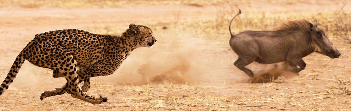
- Cheetah: Namibia holds the world’s largest cheetah population — approximately 3,000 of the world’s ~7,100 remaining — primarily on freehold commercial farmland, where the conservancy model has aligned farmer and cheetah interests
- Desert elephant: Stable and recovering
- Elephant overall: Growing population across Etosha and adjacent communal areas
This is not incidental — it is policy. Namibia was the first country in the world to inscribe environmental protection in its constitution (1990), and the results of that commitment are visible in the quantity and behaviour of its wildlife.
11.2 Wildlife Highlights by Destination
| SPECIES / EXPERIENCE | WHY NAMIBIA | BEST LOCATION |
|---|---|---|
| Black rhino | World’s largest free-roaming population (~1,200); Etosha holds the largest single-park group | Etosha (Okaukuejo waterhole at night); Damaraland (tracked on foot); Palmwag Concession |
| Cheetah | World’s largest national cheetah population | Etosha; private conservancies; Cheetah Conservation Fund base (Otjiwarongo) |
| Desert-adapted elephant | Unique sub-population evolved to survive in extreme aridity; travel 70 km between water sources | Damaraland / Hoanib River; Huab River; guided tracking from Palmwag |
| Desert-adapted lion | Coastal lions that swim in the ocean; hunt seals and oryx | Skeleton Coast north (fly-in only); Hoanib area |
| Cape fur seal | Largest colony in the world (80,000–100,000) | Cape Cross Seal Reserve (130 km north of Swakopmund) |
| Flamingo | Year-round flocks at Walvis Bay lagoon; one of Africa’s most accessible flamingo spectacles | Walvis Bay Lagoon |
| Hartmann’s mountain zebra | Endemic subspecies; only in Namibia and southern Angola | Namib-Naukluft; Damaraland; Oanob area |
| Oryx (gemsbok) | Namibia’s national animal; spectacularly adapted to desert heat (brain cooling via carotid rete) | Sossusvlei; Etosha; across the entire Namib |
| Night waterhole at Okaukuejo | Floodlit underground spring; watch elephant, black rhino, lion at the water from sunset to midnight — free | Okaukuejo Camp, Etosha National Park |
| Welwitschia mirabilis | Living fossil; individual plants 1,000–2,000 years old; found only in the Namib | Welwitschia Drive (Swakopmund); Namibian Natural Heritage Site |
11.3 Cheetah Conservation Fund (CCF)
Located near Otjiwarongo (north of Windhoek, between Windhoek and Etosha), the Cheetah Conservation Fund (CCF) is the world’s leading cheetah research and conservation centre and an important visitor attraction. Day visitors can tour the facilities, attend a feeding demonstration, and learn about the biological and conservation challenges facing the world’s fastest land animal. The CCF also pioneered the Livestock Guarding Dog programme — training Anatolian shepherd puppies to bond with farmer flocks and protect livestock from cheetah predation, removing the economic incentive to shoot cheetahs. www.cheetah.org.
12. Beyond Wildlife — Cultural & Geological Highlights
12.1 The Himba People
The Himba are a semi-nomadic, cattle-herding people of Namibia’s Kaokoveld region (extreme northwest, bordering Angola). An estimated 50,000 Himba remain. They are recognisable by their practice of covering their skin and hair in otjize — a mixture of butterfat and ochre that gives a distinctive reddish-brown appearance, protects the skin from the sun and insects, and is deeply embedded in Himba identity and aesthetics.
Several lodges in Kaokoveld and Damaraland offer community-sanctioned cultural visits to Himba settlements, managed with the community’s agreement and structured to provide direct income to the participants. These are not performances — they are living communities that welcome respectful visitors on their own terms.
Guidelines: Never enter a homestead without invitation through your guide; always ask permission before photographing; a gift of fabric, grain, or sugar is appropriate when visiting; children asking for sweets or coins is discouraged by responsible operators. The Himba are not a spectacle — approach as you would any meeting with a dignified host.
12.2 Lüderitz — The Most Intact German Colonial Town in Africa
Lüderitz (population ~12,000) on the southern coast is where German colonialism in Namibia began — in 1883, German merchant Adolf Lüderitz purchased the bay from the local Nama chief. The town retains an extraordinary concentration of original Wilhelmian Art Nouveau and German Renaissance Revival architecture, virtually unchanged from 1910. Walking the streets of Lüderitz — Felsenkirche (the Lutheran church on a granite kopje), the Goerke House (the most elaborate surviving colonial residence), the waterfront Turnhalle — is unlike anywhere else in Africa.
Kolmanskop: 10 km from Lüderitz, reached by a permit (available in Lüderitz): a ghost town built during the diamond rush of 1908, abandoned in 1954, and now being reclaimed by the desert. Sand fills the houses to waist height, flows through doorways, and drifts against walls in patterns that shift with every wind. One of Africa’s most photogenic abandoned settlements; morning light is exceptional for photography. Permit required; guided tours run daily.
12.3 Windhoek — The Capital
Windhoek is Namibia’s comfortable, walkable capital — a city of wide streets, clean air (at 1,654 m elevation), excellent restaurants, good museums, and a functional city centre where colonial and post-independence architecture mix without tension.
Key sites in Windhoek:
- National Museum of Namibia (two buildings): Documents the country’s pre-colonial and independence history, including the Herero-Nama genocide of 1904–08, which Germany formally recognised as genocide in 2021
- Christuskirche: 1910 Lutheran church; Windhoek’s most-photographed building; German Neo-Gothic on a hillside above the city
- Namibian Craft Centre: The largest permanent craft market in the country; Herero wooden sculptures, Himba jewellery, San beadwork, woven baskets (Caprivi region), and ostrich eggs
- Katutura Township Tour: Windhoek’s apartheid-era township (the name means “the place where no one wants to live” in Herero — named by the people forcibly removed there); food tours, street art, shebeen culture; run by community-based operators
12.4 The Herero and Nama Genocide — Context for Visiting
From 1904 to 1908, German colonial forces carried out what historians recognise as the first genocide of the 20th century: the systematic extermination of the Herero and Nama peoples, reducing the Herero population from approximately 80,000 to fewer than 15,000. In May 2021, Germany formally acknowledged the killings as genocide and agreed to provide EUR 1.1 billion in development funding to the communities affected.
This history is present throughout Namibia — in place names, in architecture, in the communities of Okahandja (Herero heartland), and in the National Museum. Understanding it deepens every encounter with Namibia’s landscape and people. Responsible tour operators include this context in their itineraries.
13. Customs & Cultural Tips
- Greetings: A handshake is the universal greeting across all Namibian cultures. “Goeie dag” (Afrikaans) or “Good morning/afternoon” opens any interaction. In Himba and rural Herero communities, greetings are elaborate and unhurried — take time.
- Afrikaans as a practical language: Afrikaans is widely spoken at petrol stations, small towns, and NWR camps. A handful of basic phrases (“Dankie” — thank you; “Asseblief” — please) are welcomed.
- German-speaking Namibia: In Lüderitz, Swakopmund, and many Namibian farms, German is the first language and German-language menus and signage are common.
- Photography: Ask permission before photographing people, particularly Himba, Herero, and San individuals. In Windhoek’s Katutura, photography on a guided tour is expected; uninvited photography of residents is not. Never photograph military or police installations.
- Dress: Casual Western dress is appropriate everywhere. Swakopmund and Windhoek’s restaurants are smart-casual. In national parks, neutral colors are recommended for game drives; no specific dress code beyond common sense.
- Tipping at petrol stations: Namibia has full-service filling stations — an attendant pumps your fuel, cleans your windscreen, and checks your oil if asked. Tip N$5–10 per fill; this is customary and important to the attendants’ income.
- Wildlife rules: Etosha operates a strict stay-in-your-vehicle policy on all game drives. The only exceptions are at designated waterhole viewing areas and picnic sites. Exit the vehicle outside these areas and you may face fines. Wildlife is wild — seals bite, oryx can gore, and elephants charge without warning.
14. Safety
Namibia is one of the safest countries in Southern Africa for tourists, with low violent crime rates and a stable political environment that has been consistent since independence in 1990.
- Windhoek: Exercise normal urban caution in the CBD, particularly after dark. Klein Windhoek, Ludwigsdorf, and the main tourist hotels are considered safe. Use metered taxis or the Yango app for night travel; do not walk to your hotel from restaurants after dark in unfamiliar areas.
- Swakopmund: Very safe, compact town; the main concern is the cold ocean current if swimming (rip currents and cold temperatures; designated safe swimming areas are advised by locals).
- National parks: The primary safety risks are wildlife-related (stay in your vehicle) and road-related (see Section 8.2). Follow park rules.
- Self-drive risks: The most serious safety issue for independent travellers is road accidents — particularly driving on unfamiliar gravel at excessive speed, or driving after dark. Never drive after dark, full stop.
- Fuel risk in 2026 (specific): Running out of fuel in a remote area (Damaraland, Skeleton Coast, Kaokoveld) is a genuine emergency — there is no mobile signal and potentially no other vehicles for many hours. Fill up obsessively; carry extra fuel.
- Desert safety at Sossusvlei: Heat exhaustion and dehydration are real risks in October and November, when midday temperatures on the dune surface can reach 50°C. Climb dunes only before 09:00; carry 3+ litres of water per person; turn back if you feel dizzy.
- Political situation: Very stable. Namibia has held peaceful elections since 1990; demonstrations are rare and confined to Windhoek.
Current travel advisories:
15. Ready to Plan Your Namibia Journey?
African Travel Hub designs tailor-made Namibia itineraries — from fully guided fly-in lodge circuits to self-drive itineraries with pre-booked NWR camps and private lodge combinations. Whether you are planning a classic 14-day circuit (Windhoek → Sossusvlei → Swakopmund → Damaraland → Etosha) or a specialist programme combining the Skeleton Coast with the Zambezi Region, our consultants can match your budget, travel style, and available time to the right itinerary and the right accommodation.
Request a Custom Namibia Safari Quote →
Last Updated: August 2026 by African Travel Hub Editorial. Entry requirements, park fees, and health guidance are subject to change — always verify with official sources before travel.